2024-12-15 02:41:28|Myriagame |source:minecraft skins
Notice!This mode is stopped and will not add new features.If you want to play it, please see Terraplusplus.

Terra 1 to 1 Minecraft Earth Project
Co -developed by Orangeadam3 and Shejan0, shejan0 is also responsible for image work.
It is a sub -module of the CUBICWORLDEN and OpenCubicchunks projects.
Thanks to our other personnel and communities along the way: Barteks2X, KDOTJPG, WOZAT, Minecraft, Fyreburns and so on.Without you, there is no such module
Photo: Bronze Canyon in Qiwawa, Mexico

List of function:
Concrete roads, stone roads, and lawn trails on OpenStreetMap
(Most of the cases) Use public terrain data to obtain accurate altitude height and biological group distribution
Trees generated by high -resolution forest covering data
The simple ocean generated based on altitude height and accurate depth (will be improved in the future version)
"Custom World GUI", does not require Malisis Core
Customized map projection
Enable or disable the generation of roads (can also be achieved by disabling the generation of buildings)
Enable or disable experimental options, such as smooth mixing (thanks to the user KDOTJPG code)
Use the latitude and longitude to be transmitted, "/TPLL latitude and longitude [altitude]"
Use decimal latitude and longitude format (for example: "/TPLL 36.0660 -112.1172" instead of "36 ° 03'57.6" n 112 ° 07'01.9 "W"))
If the altitude is left empty, you will be on the surface of this location
The ore will be generated under the surface (therefore, if you are on the peak of Mount Everest, you don’t have to dig more than 8,000 grids to find diamonds)
Caves, dungeons, and other standard underground structures are still available. The program will use CubicWorldGen as the benchmark to generate
what is it?
Terra 1 to 1 is a forge module of Minecraft. It adds a new world type to Minecraft. It uses public online data to generate the structure and characteristics of the earth, and does not include any unfamiliar blocks and biological groups. The proportion is 1: 1:1;
The main features available are terrain, biological groups, trees, and roads, all of which come from reality global online data;
This module is constantly developing and updating, adding more functions and optimizing the module to achieve a better connection between the real world and the module world;
The latest version can be compiled from GitHub.
How to do it?
First of all, CUBICCHUNKS adds a three -dimensional space to the existing Minecraft block system, providing more accessibility at the vertical height;
CubicWorldGen is an extended module of Cubicchunks, which allows a world with a three -dimensional block, not a two -dimensional world of ordinary MineCraft;
Modify CUBICWORLDEN and use the data of the three -dimensional terrain, biological groups and artificial buildings in the real world to generate a three -dimensional world.
What is the difference between the earth model provided by other modules?
This module does not generate the world according to the percentage ratio of the real world (such as 1: 2000), but to generate the world at a ratio of 1: 1 (the actual proportion changes according to the latitude).Each square block is equivalent to 1 meter in the real world.Because of this, it can have more specific characteristics, such as roads (future versions added), smaller streams and pudding.
Picture: The height of Mount Everest has never been as high as it is now.

The currently used API:
Altitude data downloaded in real time from AWS Terrain Tiles (@Mapzen, OpenStreetmap, etc.);
Tree coverage data is downloaded from the World Resources Research Institute Arcgis REST TREEECOVER2000 image server in real time. At first, it came from Landsat 7 ETM+(formerly CC By 4.0);
The road (coming, and water) data is obtained from OpenStreetmap under the open database license agreement.It uses a public Overpass API instance for real -time download (@OpenstreetMap contributor);
Climate (rain and temperature) data from the climate data file of the Climate Research Center of the University of Travel (built in the module);
The soil data comes from the global soil area map of the Natural Resources Protection Agency of the Ministry of Agriculture (built in the module).This module needs to download data from the Internet in real time!It requires a normal job network connection, which cannot work offline!Do not use the mobile network, unless you have unlimited data traffic!
Public server:
We now have a public server, you can test this module without installation!
The server is currently hosted by the AANG23 of Cubic Chunks Discord. It was originally hosted by FyrebURNS. You need to install Forge and Cubicchunks at least to enter!
Add or use the IP directly to add a new server:
terra.altillimity.com
If you have a connection problem, make sure your game only loads Forge and Cubicchunks.
This is also another work that is ongoing, and ownership and things may change due to AANG23 or Fyreburn. We are very grateful to the resources that Aang23 contributes to this public server and the resources contributed by Fyreburns in the past.
If you can't enter, the server may be closed, don't send spam to Aang23 or we send it, please try it later.
We cannot guarantee that the server's module is in the latest version, and it may be behind several versions.
Thank you AANG23 and Fyreburns for their efforts. Thank you very much.
——Shejan0 and Orangeadam3
Prerequisites:
2847 or 2768 version of the forge (this module is currently tested under these two versions);
Standard Cubicchunks module;
Standard CubicWorldGen module;
It is recommended to use a 0.0.85.0 or higher version of the CubicWorldGen module (the old version of CubicWorldGen and Terra 1 to 1 are in conflict);
Malisis Core (currently Terra 1 to 1 does not support Malisis Core, which will change in future updates, but the original generating method inside CubicWorldGen does support Malisis Core);
If you use the old version of the CubicWorldGen module to load Terra 1-TO-1 by the default Custom Cubic world, then the newly generated block may have strange cut-off surfaces.
How to use the client:
After installing the module, when creating a new world, a new option is added to the world type, which will be added to the option called "Planet Earth". This option will allow you to use a new generation method to generate a world;
After generating the world, you will appear near "0,0,0," near (also known as "0 ° n, 0 ° E" or "empty island").The test area, it will not be generated under the ocean.You may need to use transmission to leave this place and click to view the coordinates of a specific place.
How to use the server:
For the explanation of how to use this module on the Minecraft Forge server, please check the official server operation instructions.
Streaming media:
In order to make our module appear on CurseForge, we created a Twitch account; we created a Twitch account;
Because the Twitch account can be used for live broadcast, shejan0 has been considering using the account for live broadcast;
Click to follow the official TheterraDev Twitch account;
If you use this module and hope to officially host your Twitch live broadcast, please tell Shejan0.
Photo: Avai Patto in Arizona Grand Canyon
Known questions:

This module is still under development, and we are still solving problems we have found or are being discovered. Here we list some known problems existing in this module:
There is a problem with the generation of water, it is usually "broken". Some of these problems will be repaired after the new waters are generated;
The land that is lower than the sea level is covered by water (such as some areas of the Netherlands, the Lixi, the Dead Sea area, the Emperor Valley, etc.);
The coastline is fragmented, and there is almost no normal beach;
Except for the ordinary waters generated by the Minecraft generation system, there are no other rivers or lakes higher than the sea level;
A strange shape of the ocean appears, or appears in the form of land (such as the early Chuzi meridian near the empty island). This problem may never be completely solved, because fundamental is fundamentalCaused, but its severity can be reduced;
The shape of the biological group usually presents a 4 -kilometer block of the boundary (this problem can be solved by some clever interpolation or perlin noise); the biological group classification in some places is incorrect (this can be more thorough classification by a more thorough classificationTo improve);
The drops of seeds or flowers occasionally appear on the road (the author does not fully understand this).
Future plan:
Lakes, rivers and coastlines generated based on the actual position of OpenStreetMap;
Update forest data from 2000 to 2012;
The two ends of the 180 -degree meridian line (maybe just transmit the player from one side to the other);
A "new" lower bound, and the 1 -square forward in this lower realm is equivalent to 1000 squares in the main world, not the original 1: 8 ratio.This makes it possible to not cheat for a global survival journey, because the other side of the trip to the earth can only travel 20,000 square meters in the lower bounds.
Additional GUI interface function:
The proportion of changing the world (vertical or horizontal);
Enabling may not be a mysterious feature that everyone likes (such as the signs at the intersection of the cross);
Customize the rebirth point;
Normal generation options, such as the generation frequency of cave or ore.
More orders so that you can travel around the world through the following operations:
Convert latitude and longitude to Minecraft coordinates (vice versa);
Tell the situation in the surrounding areas, such as the name or address of the street.

National Service DNF Dark Ni
2025-01-28 09:19:27
The new screenshot of the be
2025-01-28 09:18:57
The 15th anniversary wallpap
2025-01-28 09:18:27
3DM Xuanyuan Sinicization Gr
2025-01-28 09:17:57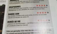
French magazine is the first
2025-01-28 09:17:27
The sneak game "Republic" wi
2025-01-28 09:16:57
The story between humans and
2025-01-28 09:16:27
Capture "Trinity 3: Artifact
2025-01-28 09:15:27
Wind direction change "Myste
2025-01-28 09:14:57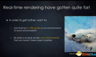
DICE's new project "Dream" w
2025-01-28 09:14:27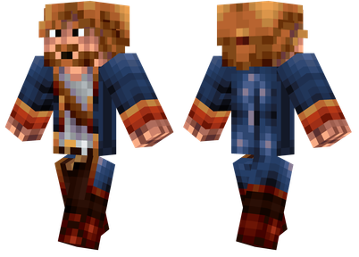
Pirate Minecraft Skins
Minecraft Skins
2024-12-10 04:11:27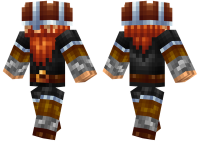
Pirate Minecraft Skins
Minecraft Skins
2024-12-10 04:11:26
Master Minecraft Skins
Minecraft Skins
2024-12-10 04:11:25
King Minecraft Skins
Minecraft Skins
2024-12-10 04:11:25
Guide Minecraft Skins
Minecraft Skins
2024-12-10 04:11:24
Dark Knight Minecraft Skins
Minecraft Skins
2024-12-10 04:11:23
Sparta Minecraft Skins
Minecraft Skins
2024-12-10 04:11:23
Moncraft Skins of the War
Minecraft Skins
2024-12-10 04:11:22
Red Witch Minecraft Skins
Minecraft Skins
2024-12-10 04:11:22
Golden Cavaliers Minecraft S
Minecraft Skins
2024-12-10 04:11:22